
Seabed mapping
Jamie McMichael-Phillips, Project Director of the Seabed 2030 Project, describes the unprecedented scope of the initiative, its progress and its tasks for the next 10 years
The benefits of a complete map of the ocean floor would be plentiful; however such a map does not yet exist. While we have come a long way in land mapping, much remains unknown about what lies beneath our oceans, which cover 71 per cent of our planet.
The Nippon Foundation-GEBCO Seabed 2030 Project (Seabed 2030) is a collaborative project between the Nippon Foundation and the General Bathymetric Chart of the Oceans (GEBCO), with a mandate to map the entire ocean floor by 2030.
Launched in 2017 at the United Nations Ocean Conference, Seabed 2030’s mission is aligned with the UN’s Sustainable Development Goal 14: to conserve and sustainably use the oceans, seas and marine resources. An understanding of the depth and shape of the seafloor is fundamental to ensuring a range of global safety, security and health issues. Knowledge of the seabed topography will enable us to better understand ocean circulation, tides, underwater geo-hazards – all of which can enhance other pertinent issues of safety, such as tsunami forecasting. Expanding the coverage of our oceans will also play a key role in the development of wave energy conversion, which is becoming increasingly popular.
But perhaps the most valuable use for a complete map of the ocean floor is the inevitable role it will play in allowing us to better understand, and ultimately mitigate, the effects of climate change. According to scientists we have less than ten years left to prevent irreversible damage from climate change. A complete map by 2030 will play a critical role in monitoring sea level rise, ocean acidification and biodiversity.
Seabed mapping is also vital for the security, safety and economic health of nation states. With billions of people relying on fish as a source of protein, a deeper understanding of the sea floor will strengthen our understanding of marine ecosystems and marine life for the benefit of current and future food supplies, in a sustainable manner.
And yet, before Seabed 2030 was launched, only 6 per cent of our oceans had been mapped to modern standards in the world’s most comprehensive digital bathymetric map: the GEBCO global grid of the ocean floor. At the time of writing, 19 per cent of the entire ocean floor has been mapped – with the latest GEBCO Grid, published just last month, recording an increase of 4 per cent since the previous year. A joint project of the International Hydrographic Organization (IHO) and the Intergovernmental Oceanographic Commission (IOC) of UNESCO, GEBCO is the only intergovernmental organisation with a mandate to map the entire ocean floor.
Funding

The Nippon Foundation, a private nonprofit foundation, is committed to a range of philanthropic activities, including passing on the riches of the ocean to the next generation. The foundation has a long history of involvement in maritime affairs, and Chairman Mr Yohei Sasakawa – who officially launched Seabed 2030 – is very active in this field. His work includes proposing the creation of a new fund to secure maritime safety in the Strait of Malacca, as well as establishing Japan’s first Basic Ocean Law. For his continued efforts, Mr Sasakawa was awarded the International Maritime Prize in 2014, by the International Maritime Organization (IMO).
The Nippon Foundation has pledged $2 million per year as seed money to Seabed 2030, which has allowed the project, now in its third year, to fund the organisational and administrative side of its activities. However, Seabed 2030 is an international project, seeking to build on its collaborative ethos in order to meet its goal, and in 2018 Mr Sasakawa called on the international community to rally behind the project. At present, Seabed 2030 is proud to have 133 official partners, contributors and supporters, and continues to pursue new collaborations in data collection and technical innovation.
Donations in kind have also helped the project achieve all that it has to date. Large volumes of data from leading surveying companies, governments and research agencies make a significant contribution to Seabed 2030. We have already been gifted hundreds of thousands of square kilometres of data which would have cost us tens of millions of dollars to acquire ourselves – and this enables us to focus our efforts on identifying areas for which no data exist.
How is the UK involved?
For the purposes of Seabed 2030, the world has been divided into four regions, each overseen by a Regional Center, which then feeds data in the Global Center based in the UK. These Regional Centers are based at: the Alfred Wegener Institute in Germany, covering the Southern Ocean; Stockholm University in Sweden, in partnership with the University of New Hampshire, US, for the Arctic and North Pacific Ocean; the Lamont Doherty Earth Observatory at Columbia University, US, covering the Atlantic and Indian Oceans; and the National Institute of Water and Atmospheric Research (NIWA) in Wellington, New Zealand, covering the South and West Pacific Ocean.
The Global Center, hosted at the British Oceanographic Data Centre (BODC), in Southampton, is responsible for producing the annual updates to the GEBCO global gridded products that are generated through the Seabed 2030 project.
The global grid is created by merging the observations that have been processed and collated by the Regional Centers into a ‘base grid’ to provide a single product. BODC is a national facility dedicated to the preservation and distribution of data concerning the marine environment, and is part of the UK National Oceanography Centre (NOC), which undertakes world-leading research in largescale oceanography and ocean measurement technology.
BODC’s origins date back to 1969, when the UK Natural Environment Research Council created the British Oceanographic Data Service (BODS). In 1989 it became the BODC, with a mission to ‘operate as a world-class data centre in support of UK marine science.’ Since 1990, BODC has been responsible for maintaining, updating and delivering GEBCO’s global bathymetric products on behalf of the project.
Choices of technology
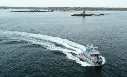
Existing and emerging technologies play a central role in the Seabed 2030 project. As multibeam echo sounders become more affordable, it will be possible to equip more vessels to contribute to the global effort. The increasing availability of this technology will also facilitate new applications. The evolution of remote technology or vehicles that can map the seafloor without a human onboard will also play a critical role. Many companies are already starting to develop unmanned surface vessels and underwater submersibles capable of diving several thousand meters below sea level and conducting ocean mapping missions.
Timescale, and Covid-19
The Seabed 2030 Project Team are spread across five countries and seven different host organisations. Each of those host organisations has taken measures to ensure the safety of their staff during the Covid-19 outbreak. While travel has been severely curtailed, individuals have taken advantage of remote working, virtual meetings and a variety of online collaboration tools to keep the project running. Currently, we have in the region of 293 million square kilometres of the world’s ocean floor still to map, and we anticipate similar levels of data contributions through donations of archive material and, as COVID restrictions abate, new data from surveys, ships transits and crowdsourcing. We expect this to allow a sustained growth of around 4 to 5 per cent in the coming year.
With just under a decade to go, Seabed 2030 will continue to act as a catalyst for the unprecedented growth in available bathymetric data. To build a map of the complete ocean floor, we will expand efforts in accelerating data collection – particularly in more inaccessible areas – and champion new technology to enable us to realise our goal. Seabed 2030 is an international initiative, and its objective, which echoes the mandate of the UN Decade of Ocean Science for Sustainable Development, will ultimately benefit humanity. We need the support of organisations and individuals across all sectors to help us achieve it.